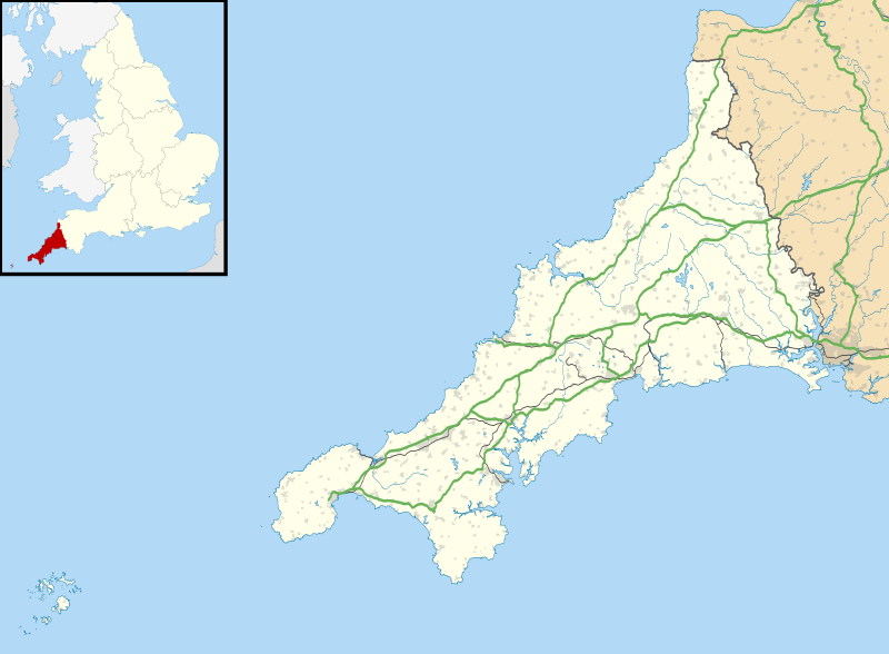
ಚಿತ್ರ:Cornwall UK location map.svg
ಗೋಚರ

Size of this PNG preview of this SVG file: ೮೦೦ × ೫೮೮ ಪಿಕ್ಸೆಲ್ಗಳು. ಇತರ ರೆಸಲ್ಯೂಶನ್ಗಳು: ೩೨೦ × ೨೩೫ ಪಿಕ್ಸೆಲ್ಗಳು | ೬೪೦ × ೪೭೧ ಪಿಕ್ಸೆಲ್ಗಳು | ೧,೦೨೪ × ೭೫೩ ಪಿಕ್ಸೆಲ್ಗಳು | ೧,೨೮೦ × ೯೪೧ ಪಿಕ್ಸೆಲ್ಗಳು | ೨,೫೬೦ × ೧,೮೮೩ ಪಿಕ್ಸೆಲ್ಗಳು | ೧,೪೨೫ × ೧,೦೪೮ ಪಿಕ್ಸೆಲ್ಗಳು.
ಮೂಲ ಕಡತ (SVG ಫೈಲು, ಸುಮಾರಾಗಿ ೧,೪೨೫ × ೧,೦೪೮ ಚಿತ್ರಬಿಂದುಗಳು, ಫೈಲಿನ ಗಾತ್ರ: ೧.೬೬ MB)
ಕಡತದ ಇತಿಹಾಸ
ದಿನ/ಕಾಲ ಒತ್ತಿದರೆ ಆ ಸಮಯದಲ್ಲಿ ಈ ಕಡತದ ವಸ್ತುಸ್ಥಿತಿ ತೋರುತ್ತದೆ.
| ದಿನ/ಕಾಲ | ಕಿರುನೋಟ | ಆಯಾಮಗಳು | ಬಳಕೆದಾರ | ಟಿಪ್ಪಣಿ | |
|---|---|---|---|---|---|
| ಪ್ರಸಕ್ತ | ೦೦:೧೩, ೨೭ ಸೆಪ್ಟೆಂಬರ್ ೨೦೧೦ |  | ೧,೪೨೫ × ೧,೦೪೮ (೧.೬೬ MB) | Nilfanion | {{Information |Description=Map of Cornwall, UK with the following information shown: *Administrative borders *Coastline, lakes and rivers *Roads and railways *Urban areas Equirectangular map projection on WGS 84 datum, with N/S stretched 1 |
ಕಡತ ಬಳಕೆ
ಈ ಕೆಳಗಿನ ಪುಟವು ಈ ಚಿತ್ರಕ್ಕೆ ಸಂಪರ್ಕ ಹೊಂದಿದೆ:
ಜಾಗತಿಕ ಕಡತ ಉಪಯೋಗ
ಈ ಕಡತವನ್ನು ಕೆಳಗಿನ ಬೇರೆ ವಿಕಿಗಳೂ ಉಪಯೋಗಿಸುತ್ತಿವೆ:
- ar.wikipedia.org ಮೇಲೆ ಬಳಕೆ
- bg.wikipedia.org ಮೇಲೆ ಬಳಕೆ
- ceb.wikipedia.org ಮೇಲೆ ಬಳಕೆ
- en.wikipedia.org ಮೇಲೆ ಬಳಕೆ
- List of lighthouses in England
- Tintagel Castle
- Chûn Castle
- Truro Cathedral
- Port Eliot
- Lanhydrock House
- Carn Brea, Redruth
- Runnel Stone
- RAF St Mawgan
- Jamaica Inn
- List of places in Cornwall
- Penryn Campus
- St Germans Priory
- Rillaton Barrow
- Roseland Peninsula
- Pendennis Castle
- Tregenna Castle
- Tregothnan
- Picklecombe Fort
- Restormel Castle
- Redruth transmitting station
- St Bartholomew's Church, Lostwithiel
- Caradon Hill transmitting station
- Goldsithney
- Mount Wellington Tin Mine
- Brisons
- Penlee Battery
- Newquay Airport
- Geevor Tin Mine
- Botallack Mine
- Pencarrow
- Camborne School of Mines
- Prideaux Place
- Cotehele
- Trerice
- Hawker's Hut
- Land's End Airport
- The Hurlers (stone circles)
- Poldice mine
- Godolphin Estate
- Lawrence House, Launceston
- RAF Davidstow Moor
- Levant Mine and Beam Engine
- Trelissick
- Antony House
- Mount Edgcumbe House
- Trengwainton Garden
ಈ ಫೈಲ್ನ ಹೆಚ್ಚು ಜಾಗತಿಕ ಬಳಕೆಯನ್ನು ವೀಕ್ಷಿಸಿ.
