ವಿಷಯಕ್ಕೆ ಹೋಗು

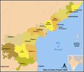
ಚಿತ್ರ:Map AP dist all shaded.png

Page contents not supported in other languages.
ವಿಕಿಪೀಡಿಯದಿಂದ, ಇದು ಮುಕ್ತ ಹಾಗೂ ಸ್ವತಂತ್ರ ವಿಶ್ವಕೋಶ

ಮೂಲ ಕಡತ (೯೨೨ × ೭೮೭ ಚಿತ್ರಬಿಂದು, ಫೈಲಿನ ಗಾತ್ರ: ೧೧೦ KB, MIME ಪ್ರಕಾರ: image/png)

This map image could be re-created using vector graphics as an SVG file. This has several advantages; see Commons:Media for cleanup for more information. If an SVG form of this image is available, please upload it and afterwards replace this template with {{vector version available|new image name}}.


It is recommended to name the SVG file “Map AP dist all shaded.svg”—then the template Vector version available (or Vva) does not need the new image name parameter.

ಸಾರಾಂಶ

ವಿವರ Map of w:Andhra Pradesh, India with district boundaries - add districts shaded.
ದಿನಾಂಕ ಜನವರಿ ೭, ೨೦೦೬ (original upload date)
ಆಕರ No machine-readable source provided. Own work assumed (based on copyright claims).
ಕರ್ತೃ No machine-readable author provided. Miljoshi assumed (based on copyright claims).
ಇತರೆ ಆವೃತ್ತಿಗಳು For updated version covering Reorganisation of Andhra Pradesh into Telangana and Andhra Pradesh File:Ap-districts.png

ಪರವಾನಗಿ

I, the copyright holder of this work, hereby publish it under the following licenses:
GNU head GNU ಉಚಿತ ಡಾಕ್ಯುಮೆಂಟೇಶನ್ ಪರವಾನಗಿ, ಆವೃತ್ತಿಯ ನಿಯಮಗಳ ಅಡಿಯಲ್ಲಿ ಈ ಡಾಕ್ಯುಮೆಂಟ್ ಅನ್ನು ನಕಲಿಸಲು, ವಿತರಿಸಲು ಮತ್ತು/ಅಥವಾ ಮಾರ್ಪಡಿಸಲು ಅನುಮತಿಯನ್ನು ನೀಡಲಾಗಿದೆ. 1.2 ಅಥವಾ ಯಾವುದೇ ನಂತರದ ಆವೃತ್ತಿಯನ್ನು ಉಚಿತ ಸಾಫ್ಟ್‌ವೇರ್ ಫೌಂಡೇಶನ್ ಪ್ರಕಟಿಸಿದೆ; ಯಾವುದೇ ಅಸ್ಥಿರ ವಿಭಾಗಗಳಿಲ್ಲದೆ, ಮುಖ ಪಠ್ಯಗಳಿಲ್ಲ ಮತ್ತು ಹಿಂದಿನ ಕವರ್ ಪಠ್ಯಗಳಿಲ್ಲ. ಪರವಾನಗಿಯ ಪ್ರತಿಯನ್ನು GNU ಉಚಿತ ಡಾಕ್ಯುಮೆಂಟೇಶನ್ ಪರವಾನಗಿ ಎಂಬ ವಿಭಾಗದಲ್ಲಿ ಸೇರಿಸಲಾಗಿದೆ.
w:en:Creative Commons
ವೈಶಿಷ್ಟ್ಯ ಇರುವುದರಂತೆಯೇ ಹಂಚು
ಈ ಕಡತ ಕ್ರಿಯೇಟಿವ್ ಕಾಮನ್ಸ್ Attribution -Share Alike 3.0 Unported ಪರವಾನಗಿ ಹೊಂದಿದೆ.
ನೀವು ಮುಕ್ತ:
  • ಹಂಚಿಕೆಗೆ – ಕೆಲಸವನ್ನು ನಕಲು ಮಾಡಲು, ವಿತರಣೆ ಮತ್ತು ಸಾಗಿಸಲು
  • ರೀಮಿಕ್ಸ್ ಮಾಡಲು – ಕೆಲಸವನ್ನು ಬಳಸಿಕೊಳ್ಳಲು
ಈ ಕೆಳಗಿನ ಷರತ್ತುಗಳಲ್ಲಿ:
  • ವೈಶಿಷ್ಟ್ಯ – ನೀವು ಸೂಕ್ತವಾದ ಕ್ರೆಡಿಟ್ ನೀಡಬೇಕು, ಪರವಾನಗಿಗೆ ಲಿಂಕ್ ಅನ್ನು ಒದಗಿಸಬೇಕು ಮತ್ತು ಯಾವುದೇ ಬದಲಾವಣೆಗಳನ್ನು ಮಾಡಿದ್ದರೆ ಸೂಚಿಸಬೇಕು. ನೀವು ಯಾವುದೇ ಸಮಂಜಸವಾದ ರೀತಿಯಲ್ಲಿ ಮಾಡಬಹುದು, ಆದರೆ ಪರವಾನಗಿದಾರರು ನಿಮ್ಮನ್ನು ಅಥವಾ ನಿಮ್ಮ ಯಾವುದೇ ಬಳಕೆಯನ್ನು ಅನುಮೋದಿಸಿದಂತೆ ರೀತಿಯಲ್ಲಿ ಉಪಯೋಗಿಸಬಾರದು.
  • ಇರುವುದರಂತೆಯೇ ಹಂಚು – ನೀವು ರೀಮಿಕ್ಸ್ ಮಾಡಿದರೆ, ರೂಪಾಂತರಗೊಳಿಸಿದರೆ ಅಥವಾ ವಸ್ತುವಿನ ಮೇಲೆ ನಿರ್ಮಿಸಿದರೆ, ನಿಮ್ಮ ಕೊಡುಗೆಗಳನ್ನು ನೀವು ಮೂಲದಂತೆ ಅದೇ ಅಥವಾ ಹೊಂದಾಣಿಕೆಯ ಪರವಾನಗಿ ಅಡಿಯಲ್ಲಿ ವಿತರಿಸಬೇಕು.
This licensing tag was added to this file as part of the GFDL licensing update.
w:en:Creative Commons
ವೈಶಿಷ್ಟ್ಯ ಇರುವುದರಂತೆಯೇ ಹಂಚು
This file is licensed under the Creative Commons Attribution-Share Alike 2.5 Generic, 2.0 Generic and 1.0 Generic license.
ನೀವು ಮುಕ್ತ:
  • ಹಂಚಿಕೆಗೆ – ಕೆಲಸವನ್ನು ನಕಲು ಮಾಡಲು, ವಿತರಣೆ ಮತ್ತು ಸಾಗಿಸಲು
  • ರೀಮಿಕ್ಸ್ ಮಾಡಲು – ಕೆಲಸವನ್ನು ಬಳಸಿಕೊಳ್ಳಲು
ಈ ಕೆಳಗಿನ ಷರತ್ತುಗಳಲ್ಲಿ:
  • ವೈಶಿಷ್ಟ್ಯ – ನೀವು ಸೂಕ್ತವಾದ ಕ್ರೆಡಿಟ್ ನೀಡಬೇಕು, ಪರವಾನಗಿಗೆ ಲಿಂಕ್ ಅನ್ನು ಒದಗಿಸಬೇಕು ಮತ್ತು ಯಾವುದೇ ಬದಲಾವಣೆಗಳನ್ನು ಮಾಡಿದ್ದರೆ ಸೂಚಿಸಬೇಕು. ನೀವು ಯಾವುದೇ ಸಮಂಜಸವಾದ ರೀತಿಯಲ್ಲಿ ಮಾಡಬಹುದು, ಆದರೆ ಪರವಾನಗಿದಾರರು ನಿಮ್ಮನ್ನು ಅಥವಾ ನಿಮ್ಮ ಯಾವುದೇ ಬಳಕೆಯನ್ನು ಅನುಮೋದಿಸಿದಂತೆ ರೀತಿಯಲ್ಲಿ ಉಪಯೋಗಿಸಬಾರದು.
  • ಇರುವುದರಂತೆಯೇ ಹಂಚು – ನೀವು ರೀಮಿಕ್ಸ್ ಮಾಡಿದರೆ, ರೂಪಾಂತರಗೊಳಿಸಿದರೆ ಅಥವಾ ವಸ್ತುವಿನ ಮೇಲೆ ನಿರ್ಮಿಸಿದರೆ, ನಿಮ್ಮ ಕೊಡುಗೆಗಳನ್ನು ನೀವು ಮೂಲದಂತೆ ಅದೇ ಅಥವಾ ಹೊಂದಾಣಿಕೆಯ ಪರವಾನಗಿ ಅಡಿಯಲ್ಲಿ ವಿತರಿಸಬೇಕು.
ನಿಮ್ಮಿಚ್ಛೆಯ ಪರವಾನಗಿಯನ್ನು ನೀವು ಆರಿಸಿಕೊಳ್ಳಬಹುದು.

Captions

Add a one-line explanation of what this file represents

Items portrayed in this file

depicts ಇಂಗ್ಲಿಷ್

copyright status ಇಂಗ್ಲಿಷ್

copyrighted ಇಂಗ್ಲಿಷ್

೭ ಜನವರಿ 2006

media type ಇಂಗ್ಲಿಷ್

image/png

ಕಡತದ ಇತಿಹಾಸ

ದಿನ/ಕಾಲ ಒತ್ತಿದರೆ ಆ ಸಮಯದಲ್ಲಿ ಈ ಕಡತದ ವಸ್ತುಸ್ಥಿತಿ ತೋರುತ್ತದೆ.

ದಿನ/ಕಾಲಕಿರುನೋಟಆಯಾಮಗಳುಬಳಕೆದಾರಟಿಪ್ಪಣಿ
ಪ್ರಸಕ್ತ೧೩:೨೭, ೮ ಮಾರ್ಚ್ ೨೦೨೧೧೩:೨೭, ೮ ಮಾರ್ಚ್ ೨೦೨೧ ವರೆಗಿನ ಆವೃತ್ತಿಯ ಕಿರುನೋಟ೯೨೨ × ೭೮೭ (೧೧೦ KB)Sbb1413Added the names of unnamed district HQs, plus the surrounding states. Removed the locator map as it (incorrectly) shows Aksai Chin as under the administration of India.
೧೨:೪೫, ೫ ಮಾರ್ಚ್ ೨೦೨೧೧೨:೪೫, ೫ ಮಾರ್ಚ್ ೨೦೨೧ ವರೆಗಿನ ಆವೃತ್ತಿಯ ಕಿರುನೋಟ೯೨೩ × ೭೯೦ (೧೦೫ KB)Sbb1413Removed Hyderabad as capital, added Amaravati, Kurnool and Visakhapatnam as capitals.
೧೬:೫೦, ೨ ಜೂನ್ ೨೦೧೪೧೬:೫೦, ೨ ಜೂನ್ ೨೦೧೪ ವರೆಗಿನ ಆವೃತ್ತಿಯ ಕಿರುನೋಟ೯೨೩ × ೮೮೧ (೮೩ KB)Adityamadhav83map updated after bifurcation of Andhra Pradesh
೧೭:೪೯, ೭ ಜನವರಿ ೨೦೦೬೧೭:೪೯, ೭ ಜನವರಿ ೨೦೦೬ ವರೆಗಿನ ಆವೃತ್ತಿಯ ಕಿರುನೋಟ೯೨೩ × ೮೮೧ (೬೩ KB)MiljoshiMap of w:Andhra Pradesh, India with district boundaries - add districts shaded. Category:Andhra Pradesh district maps

ಈ ಕೆಳಗಿನ 2 ಪುಟಗಳು ಈ ಚಿತ್ರಕ್ಕೆ ಸಂಪರ್ಕ ಹೊಂದಿವೆ:

ಜಾಗತಿಕ ಕಡತ ಉಪಯೋಗ

ಈ ಕಡತವನ್ನು ಕೆಳಗಿನ ಬೇರೆ ವಿಕಿಗಳೂ ಉಪಯೋಗಿಸುತ್ತಿವೆ:

ಈ ಫೈಲ್‌ನ ಹೆಚ್ಚು ಜಾಗತಿಕ ಬಳಕೆಯನ್ನು ವೀಕ್ಷಿಸಿ.

ಮೇಲ್ದರ್ಜೆ ಮಾಹಿತಿ

"https://kn.wikipedia.org/wiki/ಚಿತ್ರ:Map_AP_dist_all_shaded.png" ಇಂದ ಪಡೆಯಲ್ಪಟ್ಟಿದೆ